

|


|
GPS Coordinates: 42.0997495, -123.4100271
|
EXPERIENCE > LANDMARK PLACES
When you enter the Oregon Caves, the first thing you notice is the sound of rushing water echoing off the cavern’s marble walls. For Jason Walz, a cave specialist with the National Park Service stationed at Oregon Caves National Monument and Preserve, the story of the caverns begins and ends with water. Just a few feet below the metal walkway that leads you into the cave depths is the River Styx, named for a mythological waterway which divided the land of the living from the realm of the dead. It’s an ironic name. Without this pristine river, the cave would not have formed as it did nor be able to support 160 species of animals, including eight types of bats. Archaeological evidence also shows that Native Americans inhabited the area around the caves as far back as 8,500 years ago. No doubt the easy access to clean and abundant water was very appealing to these early inhabitants. “This water is really just passing through as part of a longer journey,” said Jason. “It started as rain and snow in the forest meadows above us. As it worked its way down, dripping or flowing through the cave, it’s the ground water part of our larger watershed, finally leaving the cave at the front entrance." |
No Caves Without Water
When the caves were discovered by Euro-Americans 130 years ago, they were a tourist attraction but not much attention was given to their unique natural history, including how water both destroys and creates the underground features.
“Almost every rock in the cave is marble, which is really unique because most caves in the world are formed out of limestone or,” Jason said.
Geologically speaking, the caves began as limestone islands off the Oregon coast. The movement of continental plates (tectonic plates) caused these islands to be subducted under the North American continent. The limestone was forced down ten miles (16 km) and the extreme heat and pressure caused it to metamorphose into marble. Later, when the Siskiyou Mountains formed, those marble deposits were pushed closer to the surface where water could seep into cracks and crevasses, forming the caves.
While the water may eat away at the marble in some places, it deposits it as calcite crystal in others, sometimes creating beautiful mineral formations known as draperies, stalactites, stalagmites, columns and flowstone.
A custom for early visitors was to scratch their names into these delicate formations. Although this graffiti provides an interesting record for early cave explorers and scientists, Jason cautions that this kind of vandalism is now illegal, as it damages this natural treasure.

|
Oregon Caves: The Water Connection: A national and geological treasure, the Oregon Caves National Monument and Preserve is a must-see feature for Oregon Landmark Places. Learn how water formed these amazing underground features.
|
Science in Seconds: The Global Positioning System: Finding these Landmark Places will be easier if you understand the Global Positioning System or GPS. This sophisticated system can allow a user to find any spot on earth within a few feet. Here's how it works...
Water and the State of the Ecosystem:
The NPS monitors the movement of water through the caves not only to determine how it’s affecting the rock, but also to gain information about the larger ecosystem. Instruments capture any changes in the temperature or flow of water. Air temperature is also charted, which Jason said is important for understanding how climate change may be affecting the area.
“Caves are great for assessing climate change because they are always the average temperature of the region they’re in,” he explained. “As that average temperature changes with changes in climate, we can measure it inside the cave. If the climate is stable, the temperature inside this cave should hover around 44 degrees Fahrenheit.”
Studies have shown that the water level inside the cave has changed many times over the centuries, probably due to changes in climate. The River Styx was once much deeper than it currently is and heavier water flow may have created periodic sinkholes which allowed some of the deeper parts of the cave to be accessed by large animals. Paleontologists have found the remains of black bears, grizzly bears and jaguars inside the caverns, the oldest of which dates back 50,000 years.
“By studying the formations, we know that the cave’s relatively dry compared to past eras,” said Jason. “The calcite crystal formations aren’t growing very fast right now. In fact, the last time they really grew was during the last Ice Age.”
Beyond the Cave:
Once your tour below ground is over, Oregon Caves National Monument and Preserve still has plenty to offer. An extensive visitor center and gift shop will help you interpret the cave, the surrounding watershed and provide you with ideas on where to explore next. Miles of hiking trails will lead you along the edge of streams or to overlooks with panoramic views of the. If you’re interested in staying overnight, the park offers both a historic chateau and camping facilities.
The caves are located at 19000 Caves Highway, Cave Junction, Oregon. Additional information can be found by clicking here.
Related Features: What Is White Nose Syndrome? |Medford and Vicinity
The caves are located at 19000 Caves Highway, Cave Junction, Oregon. Additional information can be found by clicking here.
Related Features: What Is White Nose Syndrome? |Medford and Vicinity
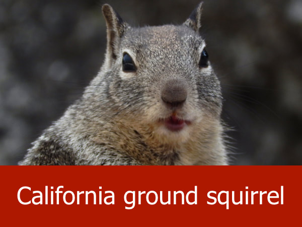
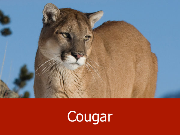
Representative Species of the Oregon Caves:
|
|


Suggested Activities for the Oregon Caves:

|

|

|

|
