

|


REGIONS > WESTERN OREGON > MEDFORD AND VICINITY
Like much of western Oregon, the Rogue River Valley was created largely through the dual forces of volcanism and erosion.
About seven million years ago, a volcano located just 24 miles (38.6 km) to the east of the valley filled the area with thick layers of lava. These flows of molten rock disrupted the Rogue River and created a thick igneous crust on top of the sedimentary layers which covered the valley floor. Once the lava hardened and the river reestablished itself, the water began to sculpt the landscape into new formations. Because water can cut faster and deeper through the sedimentary rock, the river and its tributary streams formed deep channels through these layers while leaving much of the igneous rock intact. Areas capped with igneous rock became new highlands as the landscape around them eroded away. The result is an example of a topographic inversion.
If you look carefully at the 800 foot (243 m) tall Table Rocks, you can see that the uppermost layer of the plateaus is a darker igneous rock. This “cap” protects the sedimentary rock directly beneath, although the exposed slopes of the plateaus are slowly crumbling into talus fields due to erosion by wind, rain and snow.
The Upper and Lower Table Rocks are two of the most prominent volcanic plateaus in southern Oregon.
|
GPS Coordinates: 42.4798446, -122.9337076
|
GPS Coordinates: 42.4551222, -122.9662083
|
Ascending Through the Ecosystems
As you ascend to the top of Table Rocks, you’ll pass through a variety of ecosystems. A savanna, or a grassy lowland with few trees, dominates the base where it meets the valley floor. The Native Americans who originally settled in the Medford area actively maintained this ecosystem by periodically setting fires to burn off the encroaching forest. These intentional burns would create space for new growth and eliminate dead organic material which could fuel larger, more destructive wildfires.
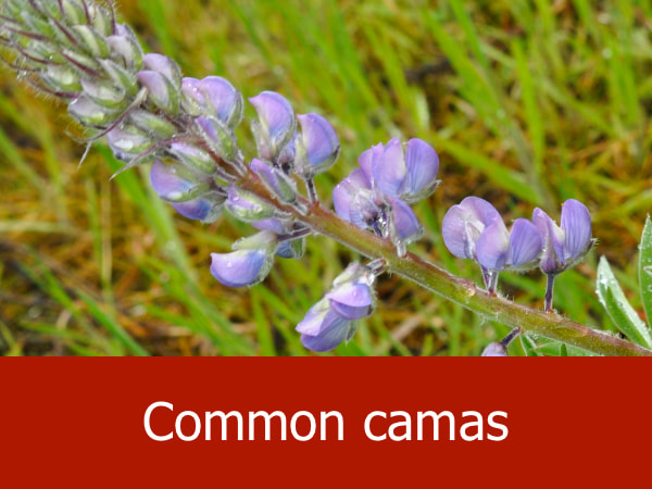
The maintenance of an open, grassy environment also lured in black-tailed deer and Roosevelt elk, and provided excellent foraging with acorns, common camas, and oil-rich tar weed seeds.
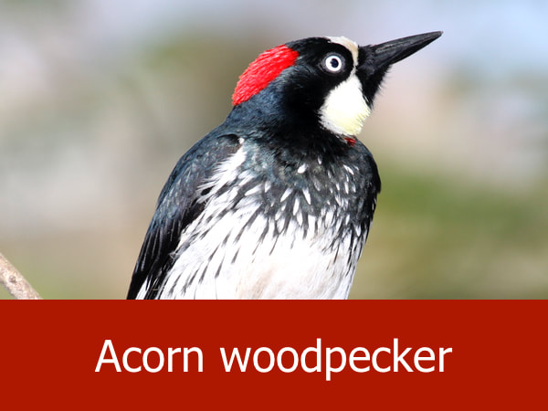
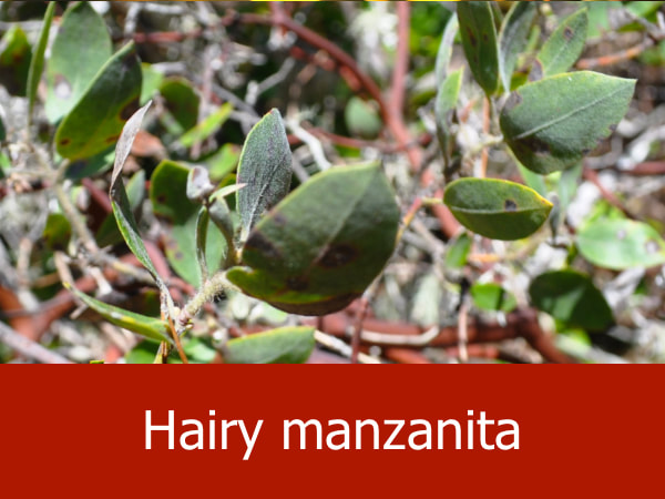
Rising in elevation, the savanna is replaced by a dry scrubland called chaparral. Buckbrush and manzanita are the most common plants in this zone, with the denser vegetation providing cover for large mammals such as the black bear. Birds like acorn woodpeckers, lesser goldfinches and Anna’s hummingbirds can all be spotted in the chaparral. It also marks the northernmost range of the blue-gray gnatcatcher (Polioptila caerulea), a tiny songbird which will rapidly pursue insects through the thickets.
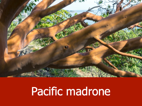
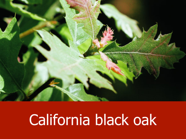
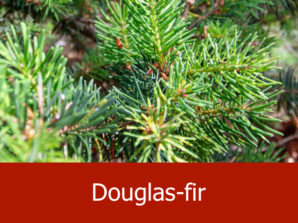
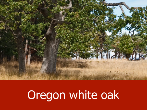
On the upper slopes of the plateaus, the chaparral gives way to a mixed woodland dominated by California black oak, Douglas-fir and Pacific madrone. The thicker canopy means cooler temperatures and less evaporation. The soil here is loamy, necessary for the retention of the moisture needed by the larger trees. Red-tailed hawks will perch in the tall tree branches watching for prey below while turkey vultures drift on the strong updrafts at the edge of the plateaus.
The top of the Table Rocks is nearly 800 feet (243 m) above the valley floor and is characterized by a prairie ecosystem dotted with vernal pools which form during the fall and winter. These oases help sustain the numerous grasses and thick wildflowers of the prairie, and are home to amphibians such as the Pacific tree frog and western toad. Large mammals are rare on the summit, but raccoons, long-tailed weasels and various types of rat find it ideal.
The maintenance of an open, grassy environment also lured in black-tailed deer and Roosevelt elk, and provided excellent foraging with acorns, common camas, and oil-rich tar weed seeds.
Rising in elevation, the savanna is replaced by a dry scrubland called chaparral. Buckbrush and manzanita are the most common plants in this zone, with the denser vegetation providing cover for large mammals such as the black bear. Birds like acorn woodpeckers, lesser goldfinches and Anna’s hummingbirds can all be spotted in the chaparral. It also marks the northernmost range of the blue-gray gnatcatcher (Polioptila caerulea), a tiny songbird which will rapidly pursue insects through the thickets.
On the upper slopes of the plateaus, the chaparral gives way to a mixed woodland dominated by California black oak, Douglas-fir and Pacific madrone. The thicker canopy means cooler temperatures and less evaporation. The soil here is loamy, necessary for the retention of the moisture needed by the larger trees. Red-tailed hawks will perch in the tall tree branches watching for prey below while turkey vultures drift on the strong updrafts at the edge of the plateaus.
The top of the Table Rocks is nearly 800 feet (243 m) above the valley floor and is characterized by a prairie ecosystem dotted with vernal pools which form during the fall and winter. These oases help sustain the numerous grasses and thick wildflowers of the prairie, and are home to amphibians such as the Pacific tree frog and western toad. Large mammals are rare on the summit, but raccoons, long-tailed weasels and various types of rat find it ideal.

|
Video Tour of Upper Table Rock: Spreading out beneath the clouds and rain is Upper Table Rock, a mesa-like formation located in southern Oregon. This brief video provides an overview of the sights and sounds of the area.
|
Why the Table Rocks Are So Unusual:
Aside from their uncommon geological history, the Upper and Lower Table Rocks are home to some very rare species. Threatened fairy shrimp live in the vernal pools, and the summits are dotted with the dwarf woolly meadowfoam, a flowering herb found nowhere else in the world.
As a result, the Upper and Lower Table Rocks were designated part of an Area of Critical Environmental Concern by the United States Bureau of Land Management (BLM). ACECs are established to protect threatened and endangered species and habitats; or important cultural or historical resources. The Table Rocks ACEC also provides an educational venue for the BLM and the Nature Conservancy, providing field trip, hiking, and picnicking opportunities for people of all ages. It is estimated that as many as 45,000 people visit the rocks every year for these purposes.
Related Features: Oak Woodlands | Valleys
Representative Species of the Table Rocks:

|

|


|

|
Suggested Activities for the Table Rocks Area:


|


|


|
|
