Between the Pacific coast and the interior valleys, a stretch of pavement draws a subtle but enduring line. Along Highway 34, Oregon nature performs not in scenes, but in transitions. Here, elevation curves into mist, forest shifts into farmland, and time seems to recalibrate itself around light. What the road lacks in notoriety, it returns in texture.
Route Overview and Geographic Anchors
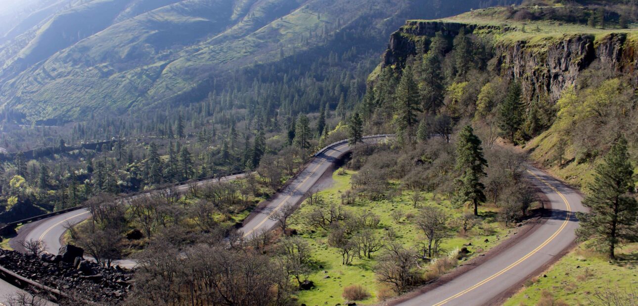
Highway 34 begins near Waldport and threads eastward toward Philomath. Though modest in length, its geography is dense. From estuarine wetlands at Alsea Bay to the fir-lined inclines of the Coast Range, each section asserts its own pace. Around mile marker 17, the road climbs subtly. Engine noise drops. Ferns reappear near culverts. And then, often suddenly, fog becomes a surface rather than a volume.
The road was not designed as a scenic route, yet its functionality reveals landscape rather than bypasses it. Unlike expressways, Highway 34 participates in the terrain. Bridges are low and unornamental. Pull-offs are gravel, sometimes uneven. It is not a place for speed, but for observant motion.
Seasonal Variations and Environmental Texture
To read Highway 34 in summer is to see dryness climb the vegetation. Grass turns brittle first near cattle fences, then in larger fields. In spring, runoff from the Siuslaw and Stony Creek accelerates, feeding temporary waterfalls just west of Nashville. Some last a day. Others, a week. But their imprint on the rock remains longer.
Winter alters not only visibility, but sound. Rain on red alder has a shallower cadence than on fir. And when wind funnels through the canyon segment before Alsea Falls, moss detaches in clumps, creating soft barriers on the shoulder. One early morning in February, a black-tailed deer was observed licking condensation off road signs, a behavior specific to drought years.
Key Stops and Microhabitats along the Drive
Certain zones along the highway operate as natural thresholds. These are not marked, but legible to those who slow down. Among the most significant:
- Alsea Falls Recreation Site: Not just a waterfall — but an entire basin, where humidity increases by degrees.
- Marys Peak Spur Access: The tallest point in the Coast Range, visible only on clear days.
- Harris Covered Bridge: A historic crossing, less noted for its age than for the cottonwoods that cluster around it.
- Alsea Bay Estuary: Where highway, river, and ocean interact in tidal dialogue.
Each stop contains microhabitats. Near Marys Peak, salamanders shelter beneath basalt fragments. At the estuary, seasonal birds adjust their arrival by barometric patterns. No sign announces these shifts, they are perceptual, not informational.
Oregon Scenic Drives and Their Ecological Role
Highway 34 is one of several oregon scenic drives that double as ecological connectors. Wildlife corridors are not always visible, but their logic is embedded in the terrain. Elk movement between Siuslaw uplands and coastal flats often parallels the road. Roadkill statistics, though grim, reveal migratory intentions. In 2021, a sharp spike in amphibian crossings was recorded after an unseasonal thaw.
These drives also function as informal observatories. Local educators use shoulder pull-offs as field classrooms. Painters return for consistent light angles. And for travelers unfamiliar with the region, a drive may become a spatial primer, a way to experience Oregon nature without stepping off pavement. That paradox, motion as immersion, makes Highway 34 an atypical, but telling, axis.
Ultimately, no summary can replace the route itself. Not because it defies description, but because it refuses uniformity. What appears in July may vanish in August. The same bend may look opaque one morning, translucent the next. And in that variability, not in monument or milestone, lies its definition.